As a swarm of locusts gear to devastate SADC country crops, sophisticated technology debates were becoming unavoidable.
Government’s recent response to the outbreak of locusts indicated its inadequate preparedness bend on using traditional systems.
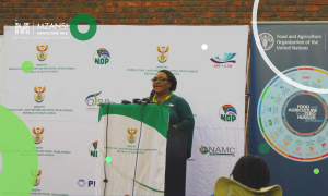
“I wish to urge farmers and farmer organisations to alert us whenever they spot these locusts and work with our officials on the ground to curb the spread,” said the Minister of Agriculture, Land Reform and Rural Development Thoko Didiza.
The use of chemical controls to contain the locusts from forming swarms has been berated as expensive as well as environmentally unfriendly by some green peace advocates.
According to the United Nations (UN) body Food and Agriculture Organisation (FAO), SADC states hit by red locusts were unable to afford the use of aircrafts every day in order to mitigate against the spread.
FAO propagated for the use of Unmanned Aerial Vehicles (UAV’S) as a measure of containing the spread in tandem providing early warning signals.
“When it comes to early warning systems, UAVs could enhance the present practices in locating outbreaks, monitoring plague development and movement and in the localized control of early-stage plague outbreaks” FAO reported.
UAV’s are commonly known as drones, and to fly or own these, one is required to apply for a license in South Africa, which could prove to be a patience exercise requiring longer wating periods and a letter of approval to use the UAV’s.
The Civil Aviation Authority of South Africa (SACAA) viewed drones as aircrafts which were also required to abide by the same law as manned aircrafts.
While the use of drones was welcomed, South African agriculture had no official UAV policy in place nor follow-up plans to do anything about it.
Rather, the focus has shouldered on the South African National Space Agency (SANAS) to aid in providing satellite images and weather forecasts.
UAV’s were found by FAO to have a higher degree of advantage than traditional remote sensing methods as in First World countries they were proving to be beneficial for farmers.
“The technology is capable of collecting very high-resolution imagery below the cloud level, with much more detail than the satellite imagery usually available to developing country analysts. They are easy to use: most drone mapping and data-collection missions are now conducted autonomously, meaning that the UAV essentially flies itself.”
Notably, these data processing applications were becoming less expensive, affording smallholder farmers the opportunity to own and use.
The Western Cape Department of Agriculture (Elsenburg) had a dedicated drone school (assisted by Drone-X, an approved drone training school) and issued its first Remote Pilot Licenses (RPL) to its staff who underwent the South African Civil Aviation Authority pilot examination.
Interestingly, most attendees were Geographical Information Systems Technicians who collected field data using Normalised Difference Vegetation Index (NDVI), Leaf Area Index (LAI), Photochemical Reflectance Index (PRI), and elevation models.
According to Future Careers, drone technologists will be the most sought-after careers of the future helping farmers and agricultural research community alike to assess vegetation health, tracking animals in order to counter poaching, and assessing the stress of crops.
Additional source: Food and Agriculture Organisation, E-Agriculture in action- drones for agriculture


